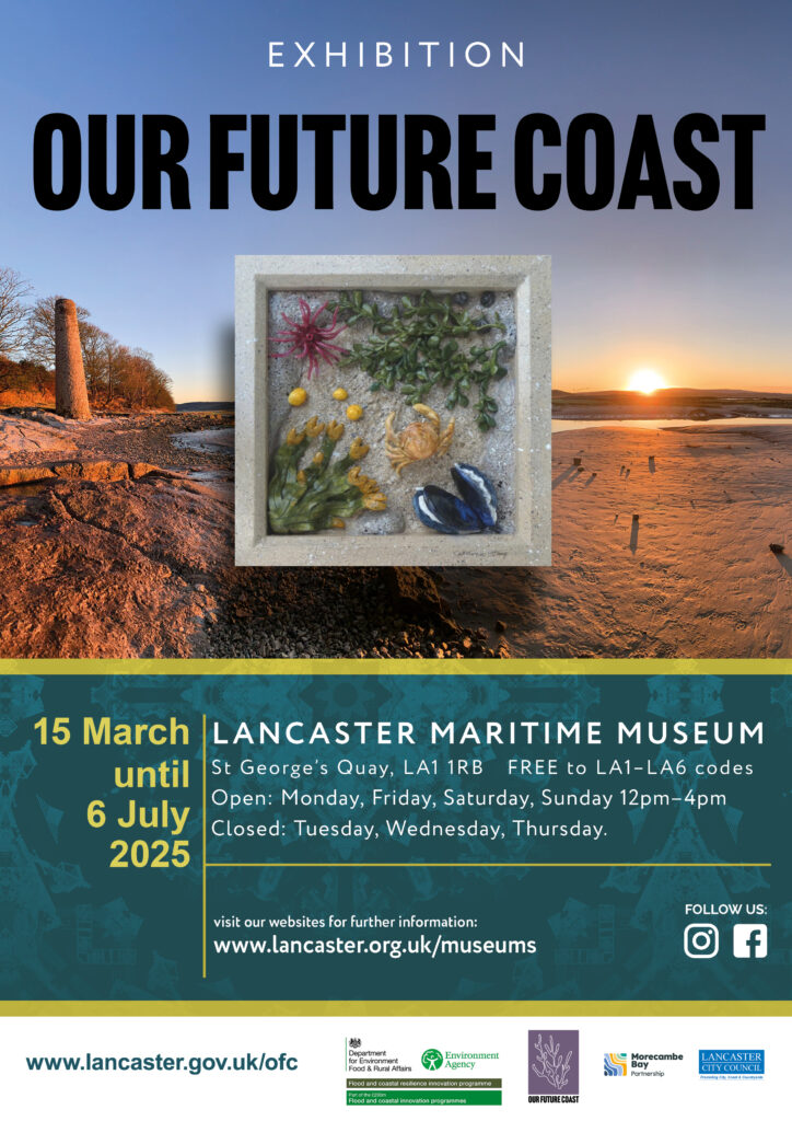

- This event has passed.
The Three Reservoirs and Turton Tower
March 22 @ 9:00 am – 4:30 pm
£15.00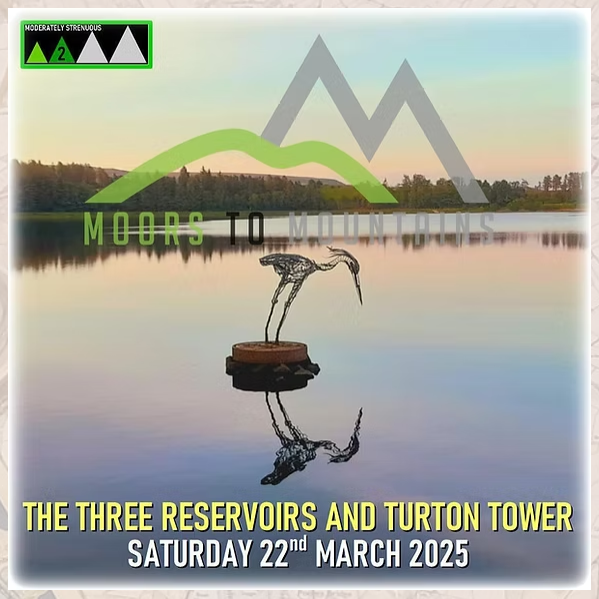
Completing a circuit of Entwistle, Jumbles and Wayoh reservoirs in the area of Turton in the West Penine Moors is a classic Lancashire walk. Popular with hikers from far and wide, my variation of the route will also include historic Turton Tower and a section of the Witton Weaver’s Way.
This is a very interesting area to visit and there are lots of facts and stories to discuss and sights to see while out on the trail. From spooky Bogarts, submerged farmsteads, civil war battles and an ancient fossilised “Calamites” trunk, participants will be offered a wealth of local knowledge from start to finish.
The overall route is 18 kilometres, or just over 11 miles, and is expected to take between 6 – 7 hours at a relaxed but steady pace. There will be intermittent breaks at multiple sites of interest and it’s really not a route march.
The Three Reservoirs walk packs a fair punch with the distance involved and participants are likely to have tired legs afterwards. The terrain beside the bodies of water is quite flat and some of the connecting paths include moderate undulation or gentle slopes. There are a couple of tougher uphill sections, but any such ascent is short lived. Expect to encounter mud, and plenty of it in some sections, and a little uneven ground in places. Overall, this activity is suitable for anybody with a moderate level of fitness and walking experience.
The route I have designed will lead us from the Strawbury Duck down to the woodland beside the reservoir known locally as “Little Wayoh”. We will cross a series of small streams and pass by the site of “Know Mill”, which was closed in 1962 to allow for this extension to the main water catchment to be flooded. Crossing Hob Lane, participants should be wary of mischievous activity from the local Boggart who is known to play crafty tricks on unsuspecting walkers.
Heading southwards, we will pass alongside Wayoh itself and climb to a scenic vantage point that looks out across the water. We will then head through Edgworth village, through Turton Bottoms and beside Bradshaw Brook towards Jumbles. This next stretch leads down the east shore of Jumbles, past the cafe and toilets, through a pleasant meadow around the Kingfisher Trail and, finally, up to Shady Lane. From here, we will continue northwards along the west shore to the disused site of Jumbles Quarry, where there is a fossilised Calamites – an ancient plant from around 350 million years ago.
Finalising the first half of the outing, we will take a muddy slope through a wooded area towards Chapeltown Road, passing a peculiar Pill Box that dates back to the second world war, and eventually arrive at the old reinforced dwelling of Turton Tower. There will be lots of historical discussion as well as a break for lunch, where it will be possible to make use of the Woodland Café and toilet facilities.
Once rested, fed and watered, we will once again hit the trail. The next section takes us across the railway and onto a stretch of the Witton Weaver’s Way that utilises a well surfaced bridleway beneath the hill Cheetham Close. The route will lead us past the site of the disused Chapeltown railway station and up into the picturesque village of Chapeltown itself, where there is a plethora of historical facts to share with the group.
We will drop down Embankment Road to the western shore of Wayoh, and follow the simple path around to the Armsgrove Viaduct and up Armsgrove Clough. This is a beautiful area at all times of year but offers a spectacular display of colour and a really pleasant atmosphere during the autumn months. This could possibly be the highlight of the walk.
Emerging at our third and final reservoir, Entwistle, the surroundings will change somewhat. Walkers are presented with a vista of coniferous trees and a wide, open expanse of water stretching northwards up the valley.
We will basically wall the entire circumference of Entwistle, passing by really pleasant woodland and of course “The Wader”, a really nice metal sculpture of a heron that stands out on a dam close to the edge of the reservoir.
The final stage will take in the eastern shore of Entwistle before hitting Overshores Road and climbing up one last hill that leads back to the Strawbury Duck.